Arkabutla Lake has a variety of great trails for hiking/nature walking, horseback riding, mountain biking, just enjoying the outdoors. The two nature/hiking trails are located near the Outlet Channel.
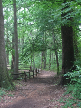 Coldwater River Nature Trail System
CURRENTLY CLOSED UNTIL FURTHER NOTICE. The North Outlet Channel Recreation Area provides access to the Coldwater River Nature Trail System. This network of trails encompasses two hiking trails (one trail is 3 miles in length and the other is 5 miles in length) and the Big Oak Nature Trail which is a self-guided interpretive trail. The area includes pristine bottomland hardwood and pine forests where an abundance of wildlife and native plant species can be found throughout. A self-guided interpretive booklet is available at the trailhead located on the north side of the Outlet Channel, or the booklet is available for download by selecting the link below.Coldwater River Nature Trail System Guidebook
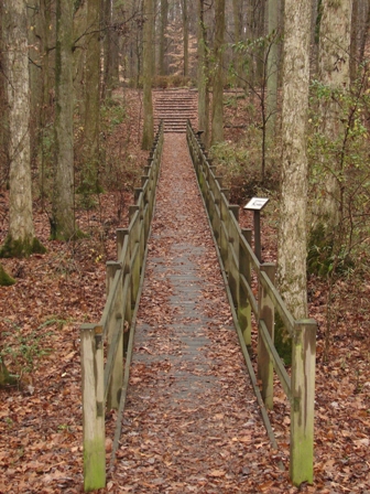 Swinging Bridge Nature Trail
CURRENTLY CLOSED UNTIL FURTHER NOTICE. The South Outlet Channel Recreation Area offers a unique trail experience. The Swinging Bridge Nature Trail is a self-guided trail that includes an old section of the Coldwater River prior to the construction of the dam. The Coldwater River was once flowing through this very trail area! Please enjoy a walk through this historic trail and learn about the history of the Arkabutla community or how the Corps of Engineers redirected the Coldwater River. Maybe you would like to learn how to identify native plants and wildlife, or just enjoy the tranquility of the trail’s azalea garden. Information panels are placed throughout the trail to help guide you along your walk.
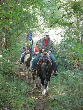 Sunfish Bay Equestrian Trail
Located in the Sunfish Bay Area, the Sunfish Bay Trail is a 4.5 mile trail designed for horseback riding. The trail, located down the first gravel road to the right as one enters Bayou Point Recreation Area, has multiple large, open unloading areas with ample room to park several horse trailers. It also has loops at the end of each gravel road for convenient trailer turn-around. Two bulletin boards are located at staging areas displaying the course layout. This trail covers many types of forest, from hilly pine forests to old growth oaks to bottomland hardwoods.
Horse Trail Map
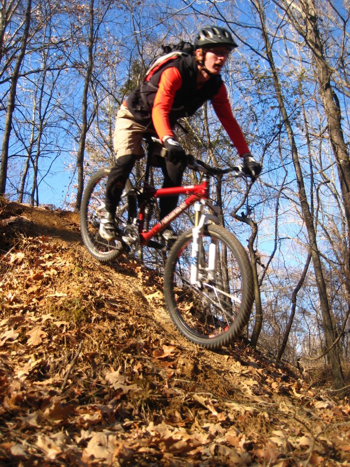 Bayou Point Single-Track Mountain Bike Trail
This fast-paced, tight, and curvy trail is designed exclusively for mountain bikes (hiking, horseback riding, etc. is prohibited). The trailhead is located past the playground on the left leg of the Bayou Point Recreation Area with a bulletin board displaying the trail layout. A series of obstacles, including jumps, "black diamond" drops, rock piles, logs, tight squeezes between trees, and narrow bridges, make this trail a fun and scenic adventure! The main trail is 5.5 miles in length; however, there are several extensions branch off of the main trail.
Bayou Point Mountain Bike Course Map
Hernando Point Single-Track Mountain Bike Trail
The Hernando Point trail system was designed and will be implemented in three stages; a 2.2 mile novice loop, an 8 mile intermediate loop, and a 16 mile advanced loop. Once completed, the entire trail system will be approximately 26 miles in length.The 2.2 mile novice loop, named The Backwater Loop, has been completed and is open for use. The intermediate loop, known as the Possum Kingdom trail, is currently under construction. It begins at the northeast corner of the Backwater trail and goes east towards Tulane road. The Hernando Point trail system is located on USACE land bordered by private property. In certain locations the trail system is located on or in close proximity to the USACE boundary. The USACE boundary is marked by yellow paint on trees and fence posts. Please remain on the trail at all times and respect adjacent landowner’s privacy
Hernando Point Mountain Bike Course Map
Trail construction photo 1
Trail Construction Photo 2
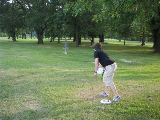 Lost Indian Spring Disc Golf Course
CURRENTLY CLOSED UNTIL FURTHER NOTICE. Lost Indian Spring Disc Golf Course is an 18 hole course located below the dam at Arkabutla Lake. Named after the natural spring that winds throughout the center of the course, it is designed to accommodate every skill level, from beginners and family outings to professional and tournament-level play. A bulletin board located at the beginning of the course displays the layout of the course on a large aerial map, and score cards are provided with a smaller course map printed on the back.
Lost Indian Spring Disk Golf Course Map
Swampy Hollow Disc Golf Course
CURRENTLY CLOSED UNTIL FURTHER NOTICE. Swampy Hollow is a 9 hole disc golf course also located below Arkabutla Dam. It is north of the Lost Indian Spring course. A bulletin board located at its beginning displays the course layout on a large aerial map. Swampy Hollow is laid out so golfers can play it as a separate course, or in conjunction with the 18 hole Lost Indian Spring course. For a 27 hole course experience, play the Lost Indian Spring course through hole 13 and then tie into the Swampy Hollow Course. The Swampy Hollow course is typically more wooded than holes on the Lost Indian Spring course.
Swampy Hollow Disc Golf Course Map